Ever since
childhood the other world that exists, the one high above the grasslands and
bushveld of South Africa, has enthralled and fascinated me with its endless
watery vistas of cloudscapes. To find a workable photographic composition in
this immense realm remains a challenge that I relish. The shapes of the clouds,
their flow, their highlights and shadows, and their colours, from the customary
white and greys at midday, through all the tints of the rainbow that compose
sunlight earlier or later in the day.
Clouds are
essentially vast collections of water droplets or ice crystals held up in air.
The mass of water that is trapped within a typical cloud can reach several
million tons. And yet, the density of the relatively warm air that holds the
water droplets in suspension is low enough that air currents below and inside
the cloud keep it hanging. Ice crystals are much lighter than water (after all
ice floats on water) and can form clouds much higher in the atmosphere under
freezing conditions.
Physical
conditions within a cloud are never static. Formation of water droplets (around
condensation nuclei such as dust or smoke particles) and re-evaporation of
water droplets into vapour occur ceaselessly. If, like me, you are often
compelled to look skywards, you too will have seen the miraculous-seeming
condensation or evaporation of clouds as unseen masses of air pass and mix in
the blue sky above you.
The type of
cloud that can form at any one time and in any specific air mass depends on
only a few local conditions of the atmosphere. The main ingredients for cloud
formation are the presence in the air of sufficient water vapour, the
turbulence or stability of the air in question, and the presence or absence of
convective uplift (that is, the presence of warmer air that will rise in
altitude). Essentially, all the different shapes and forms of clouds can be
divided into only two categories: layered and convective cloud types. In
unstable atmospheric conditions, convection of air predominates, giving rise to
vertically-developed clouds, while more tranquil atmospheric conditions give
rise to horizontal cloud layers that can extend over great distances.
When attempting
to classify cloud types, almost the only other consideration is the height at
which clouds form (remembering that the higher the altitude, the less the
density of air itself is, and so too its ability to suspend a vast mass of
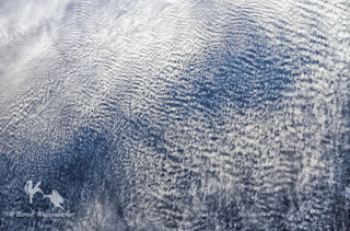
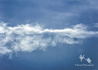
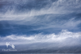
water or ice). High clouds invariably are composed of tiny ice crystals, giving
rise to wispy, layered cirrus-type clouds, often spread out in horizontal wind
currents over enormous distances. Mid-altitude clouds are composed of water
droplets, giving rise to denser, layered clouds or smaller clouds aggregated in
cloud fields. At low altitudes in the atmosphere dense, layered stratus-type
clouds or scraggly dense fields of low cumulus-type clouds form.
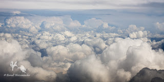
The most
dramatic clouds develop in the presence of strong convection currents in the
atmosphere. These vertical clouds have fierce internal up-draughts of air and
rise above their bases formed at various heights in the atmosphere. These
cauliflower- or anvil-shaped cumulus or cumulonimbus clouds, respectively, are
often the harbingers of rainstorms or thundershowers.
As sunlight
shines on clouds and travels through the mixture of water droplets or ice
crystals and air particles, light rays are reflected, scattered, diffracted or
absorbed by the bits of the clouds. The colour of the cloud, the wavelengths of
light that are reflected from the cloud towards the observer, of course,
depends on the colour of the light that is striking the cloud.
During midday
hours the tops of clouds and the sides facing the sunlight appear white. The
intense white light is reflected and scattered by the water droplets or ice
crystals in all directions equally. Even if the light has been diffracted at
the surface of cloud particles or inside the water droplets, the reflected
light rays from the countless molecules in the cloud recombine to give the
appearance of white light. The water droplets comprising a cloud tend to scatter
light effectively, so the intensity of solar radiation passing through a cloud
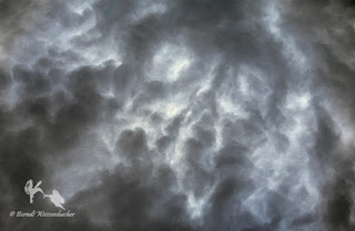
diminishes with depth into the cloud. Thus dense clouds show various shades of
grey, especially towards their bases. The same greys also appear in areas of a
cloud that are shielded from direct sunlight.
Rarely clouds
may take on a tinge of colour other than the usual white shade. Most frequently
large and very dense clouds will appear blueish-grey due to light scattering
within the clouds; the short wavelengths (blues and greens) are more easily
scattered, while the longer wavelengths (reds, oranges and yellows) are more
easily absorbed. Therefore, blueish clouds indicate strong scattering of light
by rain-sized droplets, meaning that a drenching may be imminent. Much less
frequently, clouds appear greenish; invariably such clouds are composed of
large ice crystals or hail stones that scatter strongly the green wavelengths
of light. When clouds appear yellowish, the atmosphere usually contains a large
proportion of smoke particles following large-scale fires, natural or man-made.
For a short
while, twice a day, clouds are not white and grey or tinged by subtle hues of
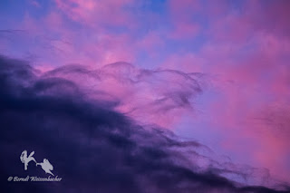
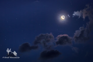
colour. At dawn and dusk, when the atmosphere and its floating clouds are still
shaded from the sun by our planet itself, only the strongly scattered short
wavelengths penetrate Earth’s shadow, painting any clouds present in intense
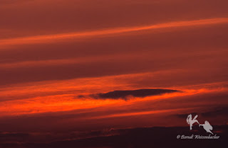
hues of violet, indigo and dark blue. As the sun peeks above the horizon in the
morning, or before it sets in the evening, clouds become a fiery spectacle of
reds, oranges and yellows, as the sun’s rays travel through the air at a
shallow angle, with the cooler colours temporarily subtracted from the light.
Whatever the
time of day, whatever the atmospheric conditions, clear skies or storms,
whatever the cloud types that form, for me the constant flux and flow and the
play of light high in the atmosphere above me remain enchanting. Clouds are the
manifestation of physical processes happening in the invisible air, giving rise
ultimately to the patterns that represent an entire world other than the
terrestrial one to which my feet are rooted. Rooted in body to Earth perhaps,
but with my imagination skipping among the clouds.

No comments:
Post a Comment